


🌾 Precision Agriculture with Satellite Imagery: Applications, Features & Benefits
Farming is no longer just about soil, water, and hard work. Today, it's about data—specifically, satellite data. Welcome to the world of Precision Agriculture with Satellite Imagery, where farmers can grow more, waste less, and make smarter decisions using real-time information from space.
Let’s explore how this technology works, its top features, and how it’s helping farmers around the world.
🌍 What is Precision Agriculture?
Precision agriculture is a modern farming approach that uses technology and data to manage crops and land more accurately. Instead of treating an entire field the same way, farmers can target specific areas based on actual conditions—like soil moisture, plant health, or pest presence.
One of the most powerful tools in this method is satellite imagery.
🛰️ What is Satellite Imagery in Agriculture?
Satellite imagery refers to pictures taken from satellites orbiting the Earth. These images are not just regular photos—they are rich with data like:
This information helps farmers monitor their fields from above, without stepping foot on the land.
📌 Applications of Satellite Imagery in Precision Agriculture
Here are some key ways satellite imagery is used in farming:
1. Crop Health Monitoring
Satellites detect stress in plants before it’s visible to the human eye. This helps farmers act early to fix issues like disease, pests, or water shortages.
2. Variable Rate Application
Farmers can apply fertilizers, pesticides, or water only where needed—based on real-time satellite data. This saves money and protects the environment.
3. Irrigation Planning
By analyzing soil moisture from satellite data, farmers can plan when and where to water crops, reducing waste and preventing over-irrigation.
4. Yield Estimation
Before harvest, satellite imagery can help estimate crop yield. This helps in planning logistics, storage, and pricing ahead of time.
5. Field Mapping & Zoning
High-resolution satellite maps help divide large farms into management zones, so each area can be treated based on its specific needs.
6. Disaster Monitoring
During floods, droughts, or frost events, satellite images help monitor the impact and guide quick responses to save crops and reduce losses.
⭐ Key Features of Satellite-Based Precision Agriculture
When using satellite imagery in agriculture, here are the top features to look for:
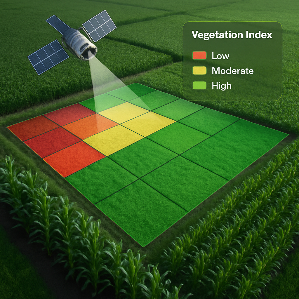
✅ NDVI and Vegetation Index Layers
These layers help detect crop health, photosynthetic activity, and chlorophyll levels.
✅ Cloud-Free Image Access
Modern platforms use AI to remove cloud cover, ensuring clear and usable images even during cloudy days.
✅ Historical Data Analysis
Access to past data (months or years) helps analyze trends, make predictions, and plan rotations.
✅ Real-Time Monitoring
Live images let farmers react instantly to any issues—saving time and money.
✅ Integration with Drones and IoT
Satellite imagery can work together with drone data and sensors on the ground to provide a complete view of the farm.
🎯 Benefits of Using Satellite Imagery in Farming
The advantages are huge—both for small farmers and large agri-businesses:
1. Better Decision Making
With clear data, farmers can decide when to plant, water, spray, or harvest—based on real crop conditions.
2. Higher Yields
Targeted treatment leads to healthier crops and increased productivity per acre.
3. Cost Savings
Avoiding overuse of water, fertilizers, and pesticides saves a lot of money.
4. Environmental Protection
Less chemical use means reduced pollution, healthier soil, and safer food.
5. Time Efficiency
Farmers can manage hundreds of acres remotely, with fewer field visits and quicker responses to problems.
6. Risk Reduction
By detecting issues early, farmers can reduce losses from pests, disease, and climate-related events.
7. Insurance and Reporting Support
Satellite data is often used in crop insurance claims, regulatory reporting, and government compliance.
🔄 Who Can Use This Technology?
Precision agriculture with satellite imagery isn’t just for high-tech farms. It’s now accessible to:
All you need is a mobile device or laptop and access to a farm management platform that offers satellite-based insights.
💡 Final Words
Precision agriculture with satellite imagery is changing the face of farming. It's helping farmers become more efficient, more productive, and more sustainable. With this technology, agriculture becomes not just smart—but future-ready.
Whether you’re growing wheat in a desert or rice in a floodplain, satellites can help you farm better from above.


