


Drone mapping is ushering in a new era of smart, data-driven agriculture across Nelson. With high-precision imagery and advanced analytics, local farmers are now able to boost crop performance, reduce waste, and make better use of every resource. This technology is helping reshape traditional farming into a more sustainable, efficient, and future-ready industry.

Why Precision Mapping Matters in Modern Farming
Farm mapping once relied on manual surveys that offered only rough estimates. Today, agricultural drones deliver high-resolution, real-time aerial data. In Nelson, experts use multispectral sensors to capture both visible and infrared imagery, allowing farmers to assess plant health, soil conditions, and field topography with remarkable accuracy.
These insights help identify stressed crops, nutrient deficiencies, pest infestations, or irrigation issues early—often long before they become visible at ground level. With this knowledge, farmers can apply targeted interventions to maximize results from every square meter of land.
Smarter Decisions for Higher Yields
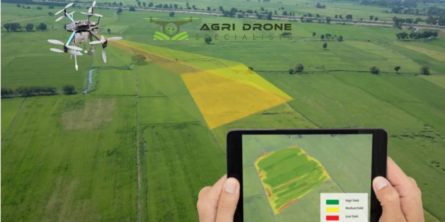
The power of drone mapping lies in its ability to convert data into actionable decisions. For example, mapping a hop farm in Nelson with a DJI drone produced NDVI (Normalized Difference Vegetation Index) maps that highlighted strong, weak, and weed-affected zones.
Farmers could easily pinpoint underperforming soil patches, irrigation gaps, and crop-stress areas that were previously unnoticed. With targeted irrigation, precise treatments, or selective harvesting, growers can improve productivity and support healthier crops season after season.
Reducing Waste and Conserving Resources
In regions like Nelson, where water and fertilizer are valuable resources, precision is essential. Drone-generated field maps make it possible to apply water, nutrients, and chemicals only where they are truly needed.
Instead of blanket applications, farmers can focus on areas with the highest return on investment. This results in significant savings in chemicals, labor, and water—making farming not only more cost-effective but also more environmentally responsible.
Maximizing Every Farm Input
Beyond crop health monitoring, drones are helping farmers plan and manage their operations more efficiently. Detailed topographical models assist with water-management design, drainage planning, and land development. When integrated with farm management software, drone data can help predict yields, plan workflows, schedule labor, and streamline logistics.
This level of precision equips Nelson’s growers to make smarter, long-term decisions for improving land use and production.
Supporting Sustainability and Future Growth
Drone mapping also plays a crucial role in promoting sustainable farming practices. With less reliance on heavy machinery and reduced chemical use, farms experience lower environmental impact. Regular drone surveys can also track erosion, disease spread, or changes in terrain, enabling proactive land stewardship that benefits future generations.
Bottom Line
Drone mapping is making Nelson’s farms smarter, more resilient, and more profitable. Local providers offer customized mapping, seeding, and surveying solutions, ensuring farms of all sizes can adopt modern precision-agriculture tools. With rapid data collection and powerful analysis, drone technology helps farmers maximize yields, minimize losses, and move toward a cleaner, more efficient farming future.
For professional drone mapping services in Nelson, contact the Agri Drone Specialists team today at 027 323 8155.


