


No two vineyards are ever the same. Row spacing, slopes, soil types, and surrounding features all influence how vines grow and how sprays behave. That’s why accurate vineyard mapping before spraying is essential. Many growers in Nelson are now turning to agricultural drone services to get a clear view of their land—and the benefits are hard to ignore.

The Foundation of Smarter Vineyard Management
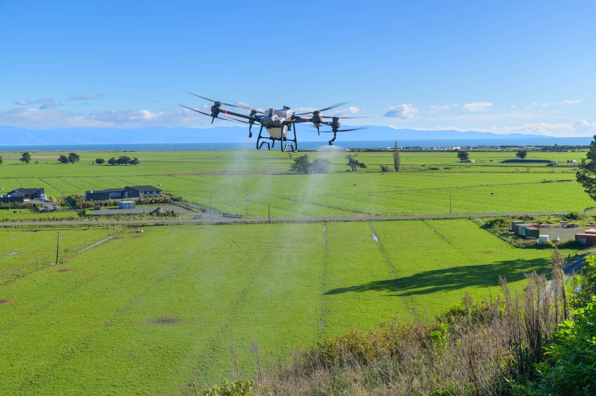
Effective spraying begins with understanding your vineyard’s layout. Precise maps help plan spray routes, set correct application rates, and ensure even coverage. Agri Drone Specialists, a trusted provider of agricultural drone services, use advanced drone technology to capture high-resolution vineyard maps with centimeter-level accuracy. These maps highlight slopes, uneven rows, and hard-to-reach areas, helping growers spray with confidence and control.
Why Vineyard Mapping Is a Smart Move
Traditional spraying often relies on outdated maps or estimation, which can lead to wasted chemicals and uneven coverage. Drone mapping removes the guesswork. Growers can identify areas with different soil moisture, sun exposure, or drainage patterns and adjust spray plans accordingly. Fine details such as boundary lines, tree shelter belts, and surface dips are clearly visible, ensuring no areas are over-sprayed or missed.
Fast, Accurate, and Efficient Data Collection
Drones can survey an entire vineyard in minutes, delivering a complete digital map before spraying even begins. This saves hours of manual inspection and allows faster, better-informed decisions. Over time, these maps also become valuable records, helping farmers track changes, monitor problem areas, and compare seasonal growth patterns.
Turning Maps into Precision Spraying
Once mapping is complete, the same drones can carry out targeted crop spraying using the captured data. This ensures sprays are applied only where needed, reducing chemical use and improving accuracy. Post-spray reports provide coverage details, offering useful insights for future planning and compliance reporting.
Healthier Vines, Less Waste
Mapped spraying minimizes overlap and drift, protecting waterways and neighbouring crops. The result is healthier vines, more uniform growth, and improved yields. For vineyards with challenging terrain, drone mapping and spraying also improve safety by keeping workers off steep or uneven ground.
Final Thoughts
Successful spraying starts with accurate mapping. By using agricultural drone services from Agri Drone Specialists, vineyard owners gain the insights they need before spraying begins. It’s a practical, efficient approach that delivers real-world results—even in vineyards with complex layouts.
Before your next spray run, start with a map. You’ll save time, reduce costs, and give your vines the care they deserve.


