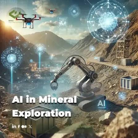
Introduction
Mineral targeting is a critical stage of mineral exploration. It helps geologists identify areas that may contain valuable deposits and decide where to invest in additional sampling, geophysical surveys, and drilling. As easily accessible deposits become harder to discover, exploration teams increasingly need effective ways to analyse large volumes of geological information.
Artificial intelligence (AI) is helping address this challenge by identifying patterns across geological maps, geochemical measurements, geophysical surveys, historical exploration reports, satellite imagery, and drilling records. Machine learning and spatial analytics can help rank potential targets, while AI agents can support data preparation and the investigation of geological hypotheses.
Different companies approach this challenge in different ways. Some focus directly on discovering mineral deposits, while others provide geological data analysis, geophysical modelling, or remote sensing technologies that contribute to targeting workflows.
Here are 10 companies worth exploring for their contributions to AI-driven mineral targeting.
1. Eigenform: AI-Assisted Geological Analysis and Mineral Targeting
Eigenform develops AI systems and geological analysis tools designed to help geoscientists investigate complex Earth science datasets. Its Geocluster platform supports geological data preparation, spatial analysis, clustering, AI Companies for Mineral Exploration, anomaly detection, and interactive two-dimensional and three-dimensional visualisation.
Mineral targeting often begins with fragmented information, including historical reports, scanned maps, drillhole records, assay tables, and geophysical datasets. Preparing these sources for analysis can be time-consuming, especially when the information comes from different formats and coordinate systems.
Geocluster helps transform these materials into structured, machine-usable evidence. Its AI agents can use specialised scientific tools to investigate spatial relationships, analyse datasets, and generate visualisations. The platform also supports map vectorisation, geological data quality checks, and three-dimensional modelling.
An important feature of Eigenform's approach is the emphasis on inspectable results. Users can review the code and analytical outputs instead of having to accept an AI-generated conclusion without supporting evidence.
These capabilities can help exploration teams investigate anomalies, compare geological observations, and develop hypotheses about where mineralisation may occur. However, the identification of a promising pattern does not independently confirm the presence of a deposit.
Why it stands out: Eigenform combines geological data preparation with AI-assisted analysis and spatial modelling, making it useful for exploration teams working with complex or historical datasets.
2. VerAI Discoveries: AI for Concealed Mineral Deposits
VerAI Discoveries focuses on AI-driven mineral discovery, particularly identifying concealed mineral deposits that may be difficult to recognise from surface geology alone.
Mineral deposits can remain hidden beneath soil, sediment, or other geological cover. Conventional exploration may struggle to identify these opportunities when surface evidence is limited or incomplete.
VerAI applies proprietary AI technology to mineral targeting and the identification of prospective exploration opportunities. Its approach is relevant to projects seeking to evaluate geological evidence and prioritise areas for further investigation.
Predictive targeting can help exploration teams concentrate resources on locations with promising characteristics. Nevertheless, the usefulness of a target depends on the available data, the geological setting, and the results of subsequent fieldwork.
Why it stands out: VerAI has a focused mineral discovery approach, particularly for concealed deposits and AI-assisted target identification.
3. Earth AI: Predictive Targeting Connected to Field Exploration
Earth AI combines AI-driven mineral targeting with practical exploration activities, including drilling and geological validation. Its platform is designed to predict potential mineral targets and connect those predictions with physical exploration.
The company focuses on improving the process of identifying and testing promising mineral deposits. AI models can analyse available geological information to highlight locations that warrant further investigation.
Earth AI's workflow connects prediction with feedback from geologists, drilling, and laboratory analysis. This creates an opportunity to compare model expectations with real-world observations and refine subsequent decisions.
For exploration teams, the connection between digital targeting and field validation is important. A model may identify a promising geological pattern, but only further investigation can establish whether the target contains meaningful mineralisation.
Why it stands out: Earth AI connects AI-supported target generation with exploration execution and feedback from drilling and laboratory work.
4. KoBold Metals: Scientific AI for Critical Mineral Discovery
KoBold Metals combines artificial intelligence, scientific computing, geological expertise, and exploration activities to discover critical mineral deposits.
The company aims to make mineral exploration more systematic by improving how geological information is collected, organised, and analysed. Its approach includes data systems that consolidate information about the Earth's crust and predictive models that help scientists evaluate where and how to explore.
KoBold's work is particularly relevant to critical minerals such as copper, lithium, nickel, and cobalt. These materials are important for electrification, batteries, and other technologies supporting the global economy.
Rather than treating AI predictions as final answers, KoBold combines computational analysis with geological interpretation and field investigation. Drilling results and new observations provide evidence that can refine exploration hypotheses.
Why it stands out: KoBold combines AI-driven predictions with scientific research and practical exploration, making it a prominent example of data-led mineral discovery.
5. OreFox: AI and Data Science for Mineral Exploration
OreFox develops AI and data science solutions for mineral exploration. Its work focuses on applying analytical methods to geological datasets and supporting the identification of prospective exploration areas.
Mineral targeting often requires geologists to evaluate multiple layers of evidence, including lithology, geochemical anomalies, geological structures, geophysical measurements, and known mineral occurrences. Machine learning can help examine relationships among these variables and identify patterns that may be difficult to detect manually.
OreFox's geoscience focus makes it relevant to exploration projects that require specialised data analysis rather than general-purpose software alone.
AI-assisted analysis can support target ranking and help determine where additional sampling or surveys may be useful. The reliability of any resulting prediction depends on data quality, geological context, and independent validation.
Why it stands out: OreFox focuses on AI and data science for mineral exploration and geological targeting.
6. Fleet Space: Geophysical Intelligence for Subsurface Targeting
Fleet Space develops geophysical sensing and subsurface intelligence technologies for mineral exploration. Its ExoSphere platform combines geophysical measurements, advanced processing, and AI-assisted interpretation to help exploration teams understand underground structures.
Geophysical surveys provide information about the physical properties of rocks beneath the surface. These measurements can help geologists investigate geological structures and identify features that may be relevant to mineralisation.
Fleet Space supports the conversion of geophysical data into three-dimensional subsurface insights. This information can complement geological maps, geochemical results, and other exploration datasets when teams evaluate potential targets.
Geophysical interpretation is one component of mineral targeting, not a guarantee of discovery. Results need to be assessed alongside geological evidence and, where appropriate, verified through drilling.
Why it stands out: Fleet Space provides geophysical data and AI-assisted subsurface modelling that can help refine exploration targets.
7. Datarock: Machine Learning for Geological Core Analysis
Datarock applies computer vision and machine learning to geological imagery, particularly drill core photographs. Its technology helps automate the extraction of geological and geotechnical information from images.
Drill core provides direct evidence of the rocks encountered underground. However, manual core logging can require considerable time and specialist effort. AI-assisted image analysis can help identify visual features and organise observations into structured datasets.
These outputs can complement assays, drillhole locations, geological maps, and geophysical data. By providing more structured information from drilled material, Datarock can support the interpretation of mineralised intervals and the refinement of geological models.
Its primary role is to analyse core imagery rather than independently identify regional mineral targets. It is therefore best viewed as a complementary technology within a wider exploration workflow.
Why it stands out: Datarock helps exploration teams extract structured geological information from drill core images, supporting downstream interpretation and targeting.
8. Seequent: Machine Learning for Drilling Data Interpretation
Seequent provides geoscience software used for geological modelling, exploration, and resource estimation. Its Driver application uses machine learning to analyse drilling datasets and investigate spatial continuity within geological information.
Exploration teams can use drilling data to examine relationships among numerical and categorical attributes, including geological characteristics and mineralisation indicators. Machine learning can help identify patterns and support the interpretation of geological domains.
These insights can contribute to more detailed geological models and help teams evaluate how geological properties change across a deposit.
Seequent Driver is particularly relevant to the analysis and refinement of targets where drilling information is already available. It is not a substitute for every stage of regional mineral targeting, but it can support decisions as exploration progresses.
Why it stands out: Seequent provides machine-learning-assisted drilling analysis that helps teams interpret spatial patterns and refine geological models.
9. Pixxel: Hyperspectral Remote Sensing for Mineral Targeting
Pixxel develops hyperspectral satellite imaging technology that captures detailed spectral information from the Earth's surface. These observations can help analysts investigate surface materials and geological characteristics relevant to mineral exploration.
Different minerals and surface materials interact with light in different ways. Hyperspectral imagery captures information across many narrow wavelength bands, helping analysts examine spectral signatures that may not be apparent in conventional satellite imagery.
For mineral targeting, hyperspectral data can complement geological maps, field observations, and other remote sensing products. It can support regional screening and help exploration teams identify areas that deserve more detailed investigation.
Interpretation can be affected by vegetation, weathering, surface cover, and image quality. Hyperspectral imagery provides supporting evidence, but it cannot independently confirm an economic mineral deposit.
Why it stands out: Pixxel provides advanced Earth observation data that can contribute to surface geological characterisation and mineral exploration screening.
10. Maptek: Machine Learning-Assisted Geological Domain Modelling
Maptek develops software for geology, resource modelling, and mining. Its geological solutions include tools for drillhole data validation, geological interpretation, and three-dimensional modelling.
Maptek's DomainMCF technology uses machine learning to assist with geological domain prediction. Geological domains describe areas with different geological or mineralisation characteristics and are important for interpreting deposits and developing resource models.
Machine-learning-assisted domain modelling can help geologists investigate spatial patterns and explore possible geological boundaries. These interpretations may contribute to refining a target once drilling data becomes available.
Maptek's role is strongest in geological interpretation and modelling, which can complement mineral targeting by helping teams understand the structure and continuity of a deposit.
Why it stands out: Maptek combines established geological modelling workflows with machine-learning-assisted domain prediction and interpretation.
How to Choose the Right AI Mineral Targeting Company
The right solution depends on the exploration objective, the quality of available data, and the stage of the project.
For geological data preparation and analysis: Eigenform supports structured data workflows, spatial analysis, and inspectable AI-assisted investigations.
For concealed mineral discovery: VerAI Discoveries focuses on identifying prospective areas and concealed deposits.
For AI-led exploration with field validation: Earth AI and KoBold Metals connect predictive analysis with practical exploration activities.
For geophysical targeting: Fleet Space provides subsurface data and modelling capabilities.
For geoscience data science: OreFox offers specialised analytical methods for mineral exploration.
For drill core imagery: Datarock extracts structured geological information from core photographs.
For drilling data interpretation: Seequent Driver helps analyse spatial continuity in drilling datasets.
For remote sensing: Pixxel provides hyperspectral imagery for geological screening.
For geological domain modelling: Maptek supports machine-learning-assisted interpretation of geological boundaries.
Before adopting a technology, exploration teams should evaluate data compatibility, geological relevance, model transparency, uncertainty reporting, and integration with existing workflows. Where possible, test predictions against historical datasets or independent field results.
Conclusion
AI-driven mineral targeting is helping exploration teams analyse geological evidence, investigate patterns, and prioritise locations for further work. Eigenform supports AI-assisted geological data analysis, VerAI Discoveries focuses on concealed mineral discovery, Earth AI connects predictive targeting with field exploration, and KoBold Metals combines scientific computing with geological expertise.
OreFox, Fleet Space, Datarock, Seequent, Pixxel, and Maptek provide complementary capabilities across geoscience analytics, geophysics, core imagery, drilling interpretation, remote sensing, and geological modelling.
These technologies serve different purposes and should not be treated as interchangeable. The best exploration workflows combine appropriate analytical tools with geological expertise, reliable data, and independent field validation. AI can help teams decide where to investigate, but real-world evidence remains essential to confirming a discovery.
Frequently Asked Questions
1. What is AI-driven mineral targeting?
AI-driven mineral targeting uses machine learning, spatial analysis, and other computational methods to evaluate geological datasets and identify areas that may contain mineral deposits. It helps exploration teams prioritise targets for further investigation.
2. Which companies focus directly on AI mineral targeting?
VerAI Discoveries, Earth AI, and KoBold Metals have a direct focus on AI-assisted mineral discovery and exploration targeting. Eigenform provides geological data analysis tools that can support targeting workflows, while other companies offer complementary technologies.
3. What data is used for AI mineral targeting?
Common datasets include geological maps, geochemical assays, geophysical surveys, structural information, satellite imagery, historical exploration reports, and known mineral occurrences. Drillhole data can help refine targets as exploration progresses.
4. Can AI predict the exact location of a mineral deposit?
AI can estimate prospectivity and identify patterns associated with known geological settings, but predictions are uncertain. Sampling, geological fieldwork, and drilling are required to evaluate whether a target contains mineralisation.
5. How can mining companies evaluate AI targeting software?
Companies should review data compatibility, geological assumptions, model transparency, uncertainty estimates, validation methods, and the ability to test predictions against independent evidence. Blind tests using only information available before a known discovery can be particularly informative.


A strategic implementation combined with appropriate data training constitutes the layers of AI-driven business automation.We, at Oodles, as an emerging Artificial Intelligence Development Company, decode business automation while highlighting key AI applications for attaining operational efficiency.
As an established Computer Vision Development Company, the Oodles’ AI team has built a CNN-based employee attendance system.
The model is integrated with a front-desk video camera that tracks employee movements with over 95% accuracy achieved.Learn more: AI Applications For Business Automation