


Construction of any structure involves a step-by-step process which includes a topographical survey and is a resource-intensive enterprise. Among the hundreds of personnel required to complete such large-scale projects, building surveyors play an important part in the whole process. Their main job involves advising architects on various maintenance procedures, keeping a check on contracts and tenders and taking care of many such administrative processes.
As their building survey career progresses, they realise that they will be required to fulfil multiple roles- as that of a quality controller, project manager, administrative duties, report to clients about a particular structure, and how any improvements (if any) need to be made. After obtaining a degree, they are required to complete apprenticeships to gain requisite experience in the field, after which they can apply for full-time jobs. Building surveyors have multiple responsibilities- like maintaining paperwork and reports about the structure planned, on-site surveys, checking for issues and then suggesting remedial measures as needed, detailed preparation of schedules and budgets, meeting with clients, ensuring safety issues are taken care of and even offering legal advice!
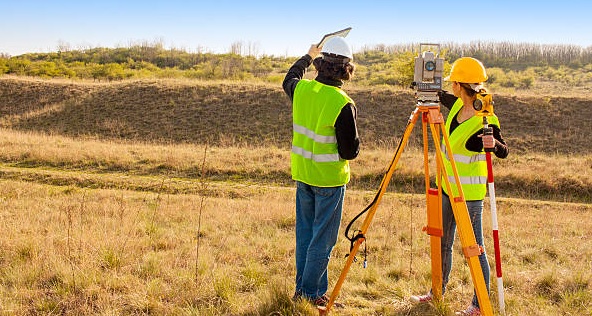
Topographical surveyors are also required to play their part in this process. They help in preparing a detailed topographical survey that is done and presented according to scale. This way, all physical features of the tract of land are to be used, along with information on elevation or such details. A good topographic survey can help contractors and developers prepare ahead.
All spatial information regarding the tract of land or area of interest is surveyed in detail, often using GPS (Global Positioning System) points. These points can help produce site sections and check for height gradients and the presence of utilities underground, among other crucial features. The various elements included in a topographical survey include- buildings, the position of vegetation, water bodies, area boundary lines, drainage features, elevation and any other features surrounding an area of interest. Computed Aided Drawing (CAD) software can then be utilised to create detailed drawings of the site.


