Every public safety incident has one thing in common—it happens somewhere.
Whether it's a traffic collision, emergency call, burglary, missing person case, or large public event, location provides critical context that can influence how agencies respond.
For years, public safety organizations have collected large volumes of operational data. But data alone doesn't tell the full story. The real value comes from understanding where incidents occur, how they relate to one another, and what patterns emerge over time.
This is where location intelligence plays a vital role.
By combining geographic information with operational data, agencies can visualize trends, improve decision-making, and respond more effectively to the communities they serve.
In this guide, we'll explain what location intelligence is, how it works, and why it has become an essential part of modern public safety.
What Is Location Intelligence?
Location intelligence is the process of using geographic data to gain meaningful insights and support better decisions.
Instead of looking at rows of information in a spreadsheet, users can view incidents, assets, and operational data on interactive maps.
This allows agencies to answer questions such as:
- Where are crime hotspots developing?
- Which neighborhoods generate the highest call volume?
- Where should officers be deployed?
- Which incidents may be connected geographically?
- What areas require additional resources?
Rather than simply storing information, location intelligence transforms data into actionable insights.
Why Geography Matters in Public Safety
Location has always been important in policing, but modern technology has significantly expanded its value.
Every incident includes geographic information such as:
- Street addresses
- GPS coordinates
- Patrol zones
- District boundaries
- Schools
- Hospitals
- Public facilities
- Transportation routes
When these data points are analyzed together, they reveal patterns that are difficult to identify through reports alone.
- For example, five incidents occurring across a city may seem unrelated until they're displayed on a map. A geographic view may reveal they all occurred within a specific corridor, near the same transportation route, or during similar time periods.
These insights help agencies move from reactive responses to proactive planning.
How Location Intelligence Works?
Location intelligence combines several technologies into a single operational workflow.
1. Data Collection
Information comes from multiple operational systems, including:
- Computer-Aided Dispatch (CAD)
- Records Management Systems (RMS)
- Incident reports
- GPS-enabled devices
- Surveillance systems
- Community reporting tools
- Public datasets
The more complete the data, the more valuable the insights become.
2. Geographic Mapping
Incident locations are plotted on interactive digital maps.
Users can quickly visualize:
- Calls for service
- Crime reports
- Patrol coverage
- Traffic incidents
- Critical infrastructure
- Resource locations
This visual representation makes complex information much easier to understand.
3. Spatial Analysis
Once data is mapped, agencies can perform geographic analysis to identify:
- Crime hotspots
- Incident clusters
- Repeat locations
- Travel patterns
- Buffer zones
- Resource proximity
Instead of asking what happened, analysts can begin asking why it happened here.
4. Operational Decision-Making
The final objective is action.
Location intelligence supports decisions related to:
- Patrol deployment
- Investigations
- Emergency response
- Event planning
- Resource allocation
- Community policing initiatives
The result is more informed operational planning.
- Benefits of Location Intelligence
- Improved Situational Awareness
Interactive maps provide an immediate understanding of current conditions.
Command staff can quickly identify ongoing incidents, available resources, and operational priorities.
This improves coordination during rapidly changing situations.
Better Resource Allocation
Staffing and budgets are limited.
Location intelligence helps agencies determine where resources will have the greatest impact.
Rather than relying on assumptions, decisions are supported by operational data.
Faster Investigations
Investigators often need to identify relationships between people, places, and events.
Geographic analysis makes it easier to connect incidents that may otherwise appear unrelated.
This can reduce investigation time while improving accuracy.
Stronger Collaboration
Public safety frequently involves multiple organizations.
Interactive mapping provides a shared operational picture that supports communication between:
- Police departments
- Emergency management
- Fire services
- Transportation agencies
- Regional partners
When everyone works from the same information, coordination becomes more effective.
Real-World Applications
Location intelligence supports a wide range of operational scenarios, including:
Crime Mapping
Visualizing crime patterns helps analysts identify high-risk areas and monitor changes over time.
Patrol Planning
Historical incident data helps agencies optimize patrol schedules and coverage.
Major Events
Cities can use geographic intelligence to coordinate road closures, emergency access routes, crowd management, and resource deployment.
Disaster Response
Location-based information helps emergency teams understand affected areas, prioritize response efforts, and allocate resources efficiently.
Real-Time Crime Centers
Many agencies use location intelligence as the foundation for Real-Time Crime Centers (RTCCs), where operational data, analytics, and mapping come together to support decision-making.
Challenges to Consider
Although location intelligence offers significant benefits, successful implementation requires planning.
Common challenges include:
Data quality issues
Disconnected operational systems
Inconsistent geographic information
Legacy software
User training
Information overload
Addressing these challenges requires both technology and well-defined operational processes.
The Role of Integrated Platforms
As agencies adopt more digital tools, integration becomes increasingly important.
Modern public safety platforms combine mapping, analytics, operational dashboards, and real-time information into a single environment.
Instead of switching between multiple applications, personnel can access relevant information through one connected operational view.
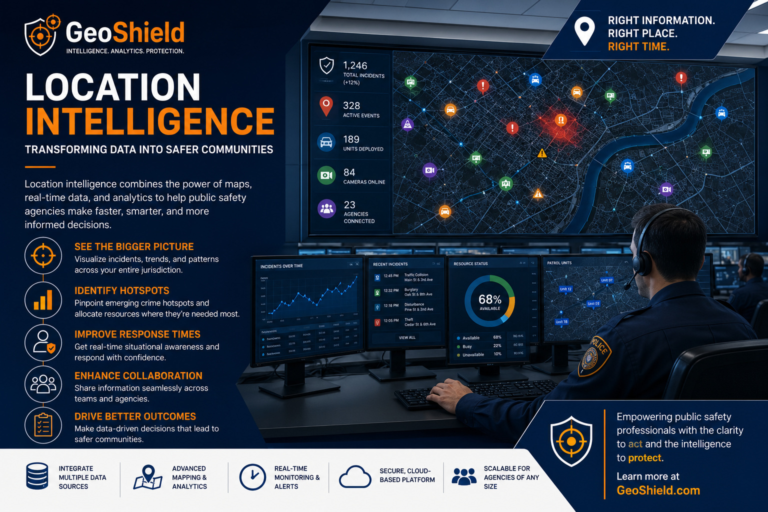
Solutions like GeoShield support this approach by integrating geographic intelligence with operational data, helping agencies improve situational awareness, streamline workflows, and make evidence-based decisions.
The objective is not simply to display maps, but to provide meaningful operational context that supports daily public safety activities.
Looking Ahead
Location intelligence is no longer a specialized capability reserved for large agencies.
Advances in cloud technology, GIS, analytics, and system integration have made geographic insights more accessible than ever.
As public safety organizations continue to modernize, location intelligence will remain a key component of operational planning, emergency response, and community safety.
Agencies that invest in connected data and geographic awareness will be better equipped to respond to today's challenges while preparing for tomorrow's.
Final Thoughts:
Every incident has a location. Every location tells a story.
Location intelligence helps agencies uncover those stories by transforming geographic data into actionable insights.
Whether improving patrol strategies, supporting investigations, or enhancing situational awareness, geographic intelligence enables public safety organizations to make smarter, faster, and more informed decisions.
Platforms such as GeoShield demonstrate how integrated mapping, analytics, and operational intelligence can help agencies build a more connected approach to public safety.
Frequently Asked Questions
What is location intelligence?
Location intelligence is the process of analyzing geographic data alongside operational information to gain insights and improve decision-making.
How is location intelligence different from GIS?
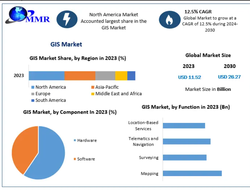
GIS (Geographic Information Systems) provides the technology for mapping and spatial analysis, while location intelligence focuses on using those geographic insights to solve real-world operational problems.
Why is location intelligence important for law enforcement?
It helps agencies identify crime patterns, improve resource allocation, strengthen investigations, and enhance situational awareness through geographic analysis.
Can small agencies benefit from location intelligence?
Yes. Agencies of all sizes can use location intelligence to improve operational efficiency, especially as cloud-based GIS and integrated public safety platforms become more accessible.
How does GeoShield support location intelligence?
GeoShield integrates GIS, operational dashboards, analytics, and real-time public safety data into a unified platform, enabling agencies to visualize information, identify trends, and make more informed operational decisions.
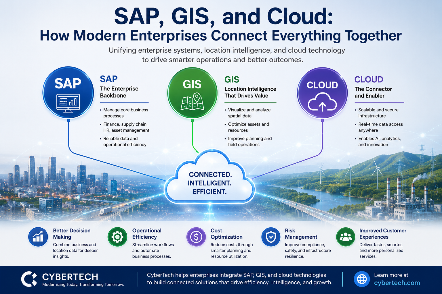
Digital Transformation: Integrating SAP, GIS, and Cloud
Digital transformation is no longer about adopting a single technology. Today's enterprises are combining business applications, geospa