


Enterprises today don't usually suffer from a lack of data. They have data in ERP systems, GIS platforms, CRM applications, asset-management tools, cloud environments, databases, and countless spreadsheets.
The bigger problem is often this:
The systems holding that data don't always agree.
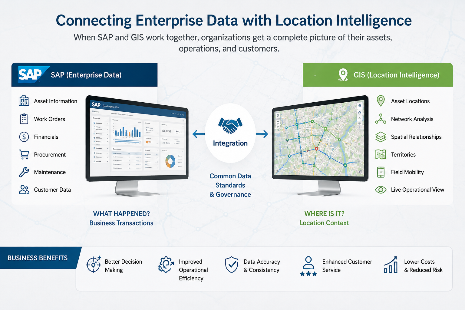
SAP may contain detailed information about assets, costs, procurement, maintenance, and business operations. GIS may contain locations, networks, boundaries, infrastructure relationships, and geographic intelligence.
Both systems can be accurate individually while still producing different answers when their information is compared.
So, why does this happen?
- SAP Knows What. GIS Knows Where.
- SAP and GIS serve different purposes.
- SAP is often responsible for the business side of an asset. It can tell an organization what the asset is, what it cost, when it was purchased, who maintains it, and what work has been performed.
GIS adds the spatial perspective.
It can show where the asset is located, what infrastructure surrounds it, which service area it belongs to, and how it connects geographically to other assets.
Individually, these perspectives are valuable.
Together, they can provide a much more complete picture.
The difficulty comes when organizations try to connect them without first addressing differences in data definitions, ownership, architecture, and workflows.
- The Same Asset Can Look Different in Each System
- Imagine a utility company has a transformer.
- SAP may identify it using an internal asset number.
- GIS may identify it using a feature ID.
The physical location might also be represented differently between the two systems.
If those identifiers aren't mapped correctly, an update in SAP may not reach the correct GIS record.
This creates a dangerous situation: both systems appear to be functioning, but they are describing different versions of reality.
This is why integration should begin with data mapping and governance, not simply API development.
Who Owns the Data?
Another important question is data ownership.
If SAP is the authoritative system for financial information but GIS is the authoritative system for geographic information, both systems need clearly defined responsibilities.
For example:
- SAP may own asset cost and procurement information.
- GIS may own geographic coordinates.
- An asset-management system may own maintenance status.
- A CRM platform may own customer information.
Without clear ownership, multiple systems may attempt to update the same information.
That can lead to conflicts, duplicate records, and synchronization problems.
Why GIS Health Matters
GIS is sometimes treated as a visualization layer, but enterprise GIS can support much more.
It may power field applications, asset management, network analysis, infrastructure planning, dashboards, location intelligence, and operational decision-making.
If the GIS environment has performance, data, security, or architecture problems, those issues can affect other enterprise processes.
This is where GIS health check services can provide value.
A comprehensive health assessment can examine areas such as:
- GIS application performance
- Spatial database health
- Data quality
- Service configuration
- Integration architecture
- Security
- Infrastructure
- Scalability
- Operational processes
The objective isn't simply to determine whether maps load.
It is to understand whether the GIS environment is capable of supporting the organization's current and future business requirements.
Integration Isn't Just About Connecting APIs
APIs are important, but an API connection alone doesn't guarantee successful integration.
Organizations also need to define how information should move between systems.
Questions include:
- How often should data synchronize?
- What happens when an update fails?
- Which system takes priority when information conflicts?
- How are errors detected?
- Who is responsible for resolving them?
- How are changes documented?
These decisions turn technical integration into a reliable business process.
The Importance of an Enterprise GIS Roadmap
Many enterprises modernize their GIS environment one project at a time.
One department introduces a new application.
Another upgrades its database.
Another moves services to the cloud.
Eventually, the organization may have multiple GIS technologies operating without a consistent long-term direction.
An enterprise GIS roadmap helps prevent this fragmentation.
A roadmap can define the current state, business requirements, data strategy, architecture, application priorities, integration needs, cloud direction, security requirements, and future capabilities.
It also helps ensure GIS modernization aligns with broader enterprise transformation.
Think About the Workflow, Not Just the Systems
The most useful integration projects start with business processes.
Consider a field maintenance scenario.
A maintenance request might originate in SAP.
The technician needs to find the asset through GIS.
The technician completes the work in a field application.
The asset status then needs to be updated across the relevant systems.
If those systems aren't connected, employees may have to enter information multiple times.
That creates additional work and increases the possibility of errors.
When the systems are properly integrated, the workflow becomes more seamless.
Better Data Can Lead to Better Decisions
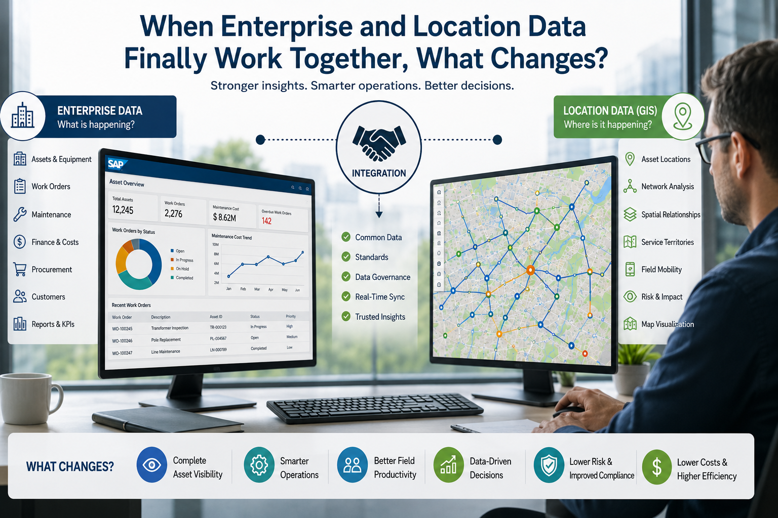
Once enterprise and geographic information are connected, organizations can ask questions that are difficult to answer using one system alone.
For example:
- Which high-value assets are located in high-risk areas?
- Where are maintenance problems occurring most frequently?
- Which infrastructure requires investment?
- Which service territories are experiencing the most issues?
- How could a new project affect surrounding assets?
- These questions combine business information with location context.
- That's where the real value of integration begins.
How Should Enterprises Start?
Rather than attempting to connect everything at once, organizations can start by identifying their most important business processes.
Then map:
Systems → Data → Ownership → Integrations → Workflows → Users
From there, identify gaps and prioritize the integrations that provide the greatest business value.
A GIS health assessment can help establish the current technical state, while an enterprise GIS roadmap can provide direction for future modernization.
Final Thoughts:-
SAP and GIS don't need to become the same system.
They need to work from a consistent understanding of the enterprise.
SAP can provide the business and operational context.
GIS can provide the geographic context.
When those perspectives are connected through strong governance, reliable integration, healthy architecture, and clear long-term planning, organizations can turn fragmented information into actionable intelligence.
The real question isn't:
“Why can't SAP and GIS agree?”



How connecting business systems with GIS can improve asset visibility, utility operations, and enterprise decision-making
Most enterprises already have plenty of data:
SAP and other bus

This article describes the online cloud computing course- public keys, private keys, and their differences.
All asymmetric key pairs are unique, so messages encrypted with a public key can only be read by someone who has the corresponding private key.
Asymmetric cryptography, or public-key cryptography, is also used by the Secure Socket Layer (SSL) protocol to create secure connections to websites in the cloud provider.3.
Can be used to create digital signatures on operating system software such as Ubuntu, Red Hat Linux package distribution at data centres.
This means that if the encryption algorithm uses a combination of addition and multiplication, the decryption algorithm uses a combination of subtraction and division.With this type of encryption in devops online training at both the sender and the receiver use a single key while communicating or sending information.
The private key is created using the same mathematical algorithms used in the public key to create a strong paired binary sequence.

IoT presented the hyper availability idea, which implies associations, and people can speak with one another from distant areas easily.
The quick blast of IoT has helped associations and, in different ways, further developed statistical surveying and business procedures.
Essentially, IoT has worked on improving the way of life of people by presenting robotized services.
In any case, a particularly uncontrolled blast has expanded protection and security challenges.
Inappropriate Security PracticesInappropriate gadget refreshes the absence of productive and powerful security conventions, client ignorance, and renowned dynamic gadget monitoring are among the difficulties that IoT is confronting.
Despite the fact that few security systems were created to shield IoT gadgets from cyber attacks, security rules are not appropriately archived.