


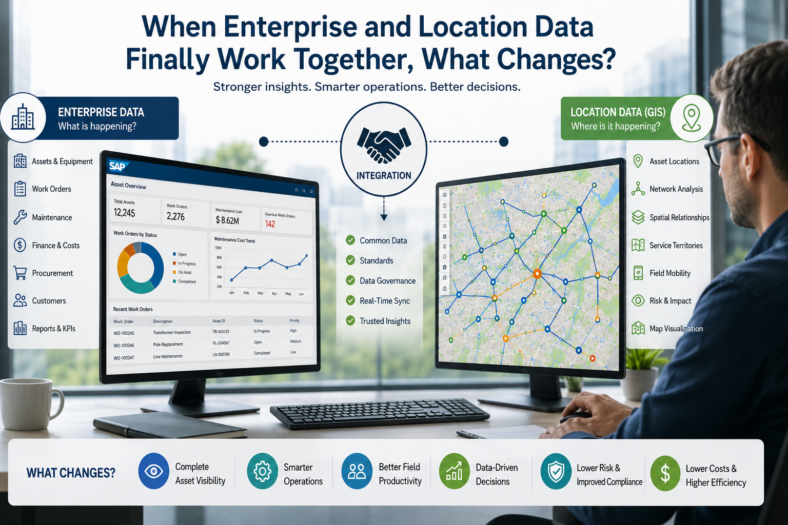
How connecting business systems with GIS can improve asset visibility, utility operations, and enterprise decision-making
Most enterprises already have plenty of data:
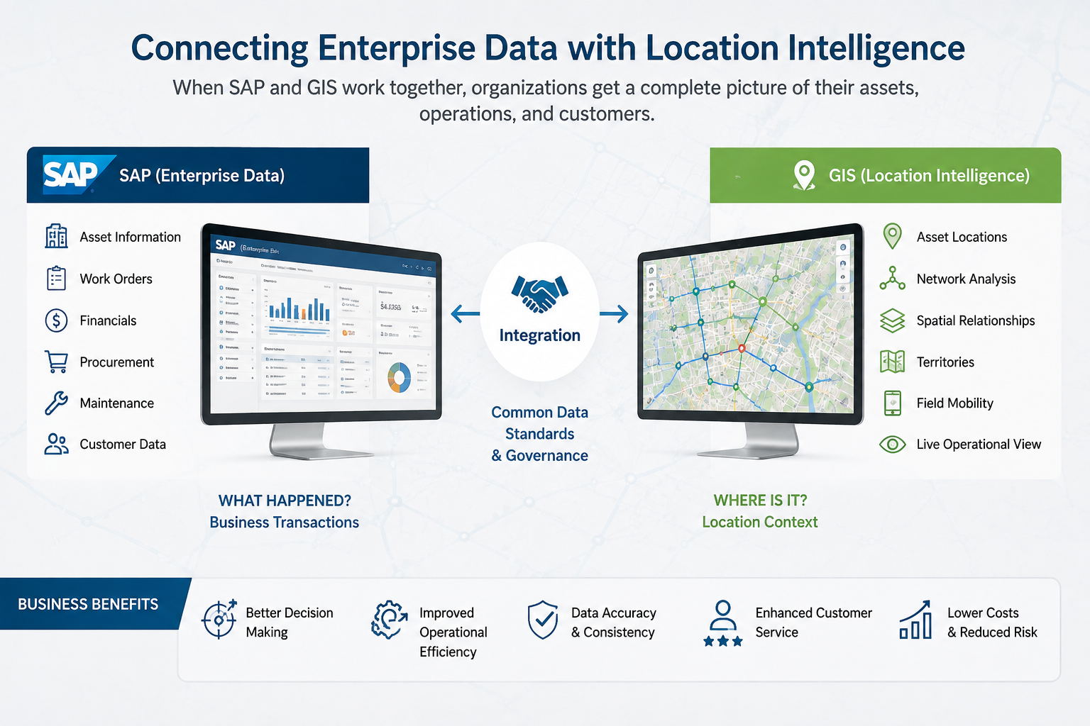
SAP and other business systems may contain information about assets, customers, maintenance, procurement, costs, and operations. GIS platforms add another important dimension: where things are, how they are connected, and what surrounds them.
Yet having both types of information doesn't necessarily mean an organization can use them together effectively.
This creates an important question:
What actually changes when enterprise and location data finally work together?
The answer goes beyond putting business information on a map. When properly integrated, enterprise and geospatial data can create a more complete view of operations and help teams make decisions with greater context.
From “What Happened?” to “Where Did It Happen?”
Enterprise systems are excellent at recording transactions and business activities.
For example, an organization may know:
- Which asset was purchased
- How much it cost
- When it was installed
- When maintenance was performed
- Which team handled the work
- What its current status is
GIS adds another layer.
It can show:
- Where the asset is located
- Which assets are nearby
- Which network it belongs to
- What service area it affects
- How it connects to other infrastructure
Together, these perspectives answer a much more useful question:
What happened, and where did it happen?
That additional context can change how organizations understand their operations.
Asset Management Becomes More Connected
Consider an organization managing thousands of infrastructure assets.
A traditional enterprise system may provide a detailed asset record, but a maintenance manager may still need geographic context before deciding what to do next.
When enterprise and GIS data are connected, the manager can potentially see the asset's business information alongside its location and surrounding infrastructure.
This can help teams understand relationships that aren't obvious when looking at a spreadsheet or database record alone.
For infrastructure-intensive organizations, this can make asset planning more practical and data-driven.
Utility Operations Can Benefit Even More
The connection becomes particularly valuable in utility environments.
Utility organizations manage networks containing interconnected assets such as lines, pipes, substations, transformers, meters, and service locations.
Changing one asset can affect other parts of the network.
This makes utility network management highly dependent on accurate location and asset information.
When enterprise records and GIS data are properly connected, teams can gain a clearer understanding of the relationship between business processes and physical infrastructure.
For example, a maintenance event recorded in an enterprise system can be connected to the relevant geographic asset and network.
That means operational teams don't have to work with isolated information.
Better Visibility for Field Teams
Field employees often need both business and geographic information.
A technician may need to know:
What equipment am I working on?
But they may also need to know:
- Where is it?
- What assets are connected to it?
- What work has already been performed?
- Which nearby infrastructure could be affected?
Integrating enterprise and GIS information can reduce the need to switch between disconnected applications.
This can improve the flow of information from the office to the field and back again.
Data Quality Becomes More Important
Integration also exposes something enterprises sometimes overlook: inconsistent data.
The same asset might have different identifiers in two systems.
A location could be recorded differently.
An asset's status might be updated in one platform but not another.
These differences can create confusion even when both systems are functioning correctly.
Before connecting enterprise and location data, organizations should establish:
- Common identifiers
- Data ownership
- Validation rules
- Synchronization processes
- Update responsibilities
- Error-handling procedures
Integration isn't simply about moving data between systems.
It's about making sure the information remains trustworthy.
Why GIS Health Matters?
An enterprise can have a strong integration strategy and still struggle if its GIS environment isn't healthy.
Poor service performance, outdated data, inefficient architecture, or weak integration processes can reduce the value of location intelligence.
This is where CyberTech GIS services can be relevant for organizations looking to assess, modernize, integrate, and support enterprise geospatial environments.
A GIS-focused assessment can help organizations understand where performance, architecture, data, integration, and operational improvements may be needed.
From Data to Decision-Making
The ultimate benefit isn't having more dashboards.
It's making better decisions.
When enterprise and location data are connected, organizations can investigate questions such as:
- Which assets require attention based on location and condition?
- Where are maintenance problems concentrated?
- Which infrastructure is exposed to specific geographic risks?
- Which areas have the highest operational demand?
- How could a planned project affect surrounding assets?
- Where should maintenance resources be prioritized?
These questions require both business information and geographic context.
Building a More Connected Enterprise
Organizations don't necessarily need to integrate every system at once.
A better approach is to begin with high-value workflows.
Identify a business process where geographic context can make a measurable difference.
Then determine:
- Which systems are involved?
- What data needs to move?
- Which system owns the information?
- How often should it be updated?
- Who is responsible for maintaining it?
This creates a practical foundation for broader integration.
What Changes When the Data Finally Works Together?
The biggest change is that organizations stop viewing enterprise data and location data as separate information sources.
They begin seeing them as two parts of the same operational picture.
Enterprise systems explain the business activity.
GIS explains the geographic context.
When those perspectives are connected, teams can gain better asset visibility, improve field workflows, strengthen utility operations, and make decisions with greater confidence.
CyberTech utility network management capabilities can be particularly relevant for organizations dealing with complex infrastructure where asset relationships and geographic context are central to daily operations.
Final Thoughts
Enterprise data tells organizations what they own, what happened, and what needs to be done.
Location data helps explain where it happened, what is connected, and what could be affected.
Bringing these perspectives together can turn fragmented information into a much clearer operational picture.
The real transformation isn't simply technical.
It's the ability to move from:
“We have the data.”
to:
“We understand what the data means in the real world.”


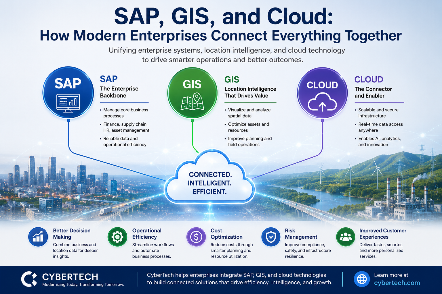
Digital Transformation: Integrating SAP, GIS, and Cloud
Digital transformation is no longer about adopting a single technology. Today's enterprises are combining business applications, geospa

This article describes the online cloud computing course- public keys, private keys, and their differences.
All asymmetric key pairs are unique, so messages encrypted with a public key can only be read by someone who has the corresponding private key.
Asymmetric cryptography, or public-key cryptography, is also used by the Secure Socket Layer (SSL) protocol to create secure connections to websites in the cloud provider.3.
Can be used to create digital signatures on operating system software such as Ubuntu, Red Hat Linux package distribution at data centres.
This means that if the encryption algorithm uses a combination of addition and multiplication, the decryption algorithm uses a combination of subtraction and division.With this type of encryption in devops online training at both the sender and the receiver use a single key while communicating or sending information.
The private key is created using the same mathematical algorithms used in the public key to create a strong paired binary sequence.

IoT presented the hyper availability idea, which implies associations, and people can speak with one another from distant areas easily.
The quick blast of IoT has helped associations and, in different ways, further developed statistical surveying and business procedures.
Essentially, IoT has worked on improving the way of life of people by presenting robotized services.
In any case, a particularly uncontrolled blast has expanded protection and security challenges.
Inappropriate Security PracticesInappropriate gadget refreshes the absence of productive and powerful security conventions, client ignorance, and renowned dynamic gadget monitoring are among the difficulties that IoT is confronting.
Despite the fact that few security systems were created to shield IoT gadgets from cyber attacks, security rules are not appropriately archived.